Introduction
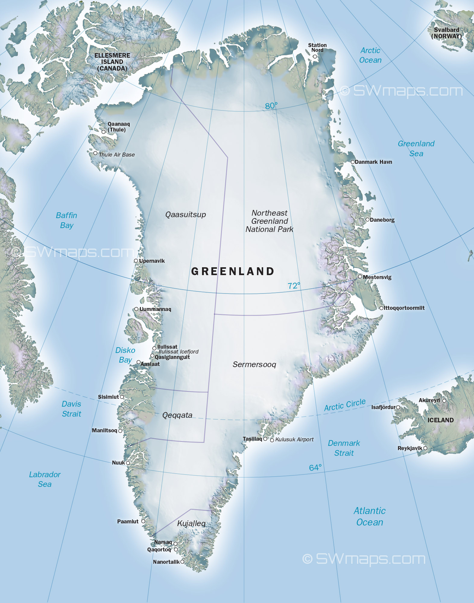
The Greenland map serves as a crucial tool for understanding one of the world’s largest islands, covering over 2 million square kilometres. As climate change continues to impact polar regions, the relevance of accurately mapping Greenland cannot be overstated. From significant geopolitical implications to the understanding of its unique ecosystems, the Greenland map is essential for researchers, policymakers, and the general public alike.
The Geography of Greenland
Located between the Arctic and Atlantic Oceans, Greenland is predominantly covered by an ice sheet that holds vast reserves of freshwater. The Greenland map illustrates various geographical features, including its two major regions: the ice-covered central plateau and the coastal areas that are more habitable. The map highlights key cities such as Nuuk, the capital, and Sisimiut, revealing the sparse distribution of the population, with over 80% of residents living along the western coast.
Recent Developments and Mapping Technology
The advent of new mapping technologies, such as satellite mapping and GIS (Geographic Information System), has revolutionised our understanding of Greenland’s geography. These modern techniques allow for real-time updates and more detailed representations of environmental changes. Recent studies, including those by the Danish Meteorological Institute, have shown alarming rates of ice melt, which are crucially depicted in updated maps of the region.
The Cultural and Historical Context
Greenland’s map is not just a representation of physical geography; it is also a testament to a rich cultural history. The Inuit people, who have inhabited the land for thousands of years, have their own names for geographical features that reflect their deep connection to the environment. Maps that incorporate local knowledge are increasingly important for sustainable development and cultural preservation.
Conclusion
In conclusion, the Greenland map serves multiple purposes, from aiding scientific research to fostering a better understanding of the island’s cultural significance. As international interest in the Arctic region grows, the importance of accurate and current maps cannot be overstated. Policymakers and environmentalists alike must rely on these tools to address the pressing issues of climate change, territorial claims, and indigenous rights. Looking to the future, enhanced mapping technologies and collaborative efforts will play a key role in securing a balanced approach to Greenland’s development and preservation.